
The Use of Drones in Building Inspections: Faster, Safer, and More Cost-Effective Assessments
Drones are transforming external building inspections, especially for roofs, façades, and other hard-to-reach areas. By flying high-resolution cameras instead of human inspectors, drones can survey every corner of a structure in minutes. One industry source notes that drones inspect roofs “ensuring the safety of employees by keeping them off hazardous rooftops” – a critical advantage since falls from heights cause roughly 35% of construction fatalities. In practice, maintenance teams use drones to replace laborious scaffolding or lifts: drones fly around a building, capture detailed imagery of damage (cracks, leaks, corrosion), and relay it back to the ground. This approach dramatically cuts inspection time and cost while eliminating many safety hazards.
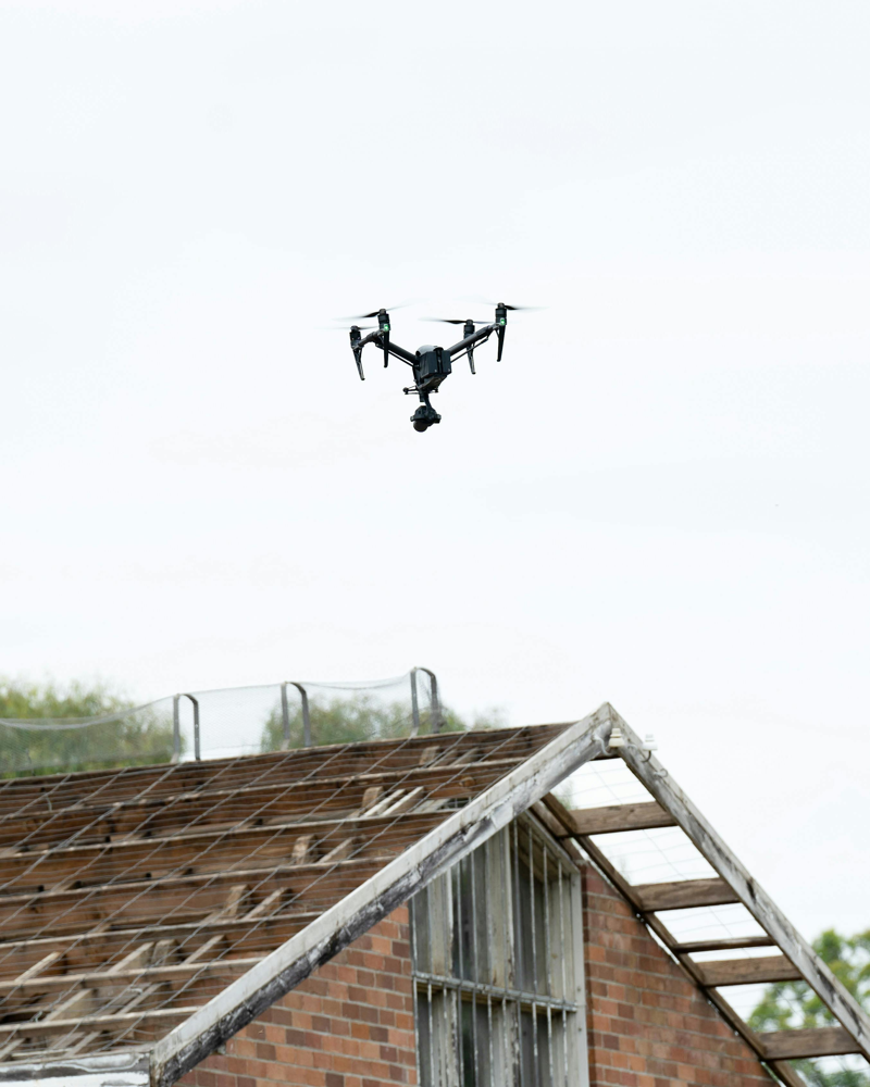
Figure: A quadcopter drone surveying a roof. By keeping inspectors on the ground, drones eliminate the need for ladders or scaffolding during inspections.
Below are the key benefits and capabilities of drone-based inspections:
- Faster inspections: Unmanned aerial surveys can cover large building exteriors in minutes rather than days. This speed comes from flying uninterrupted around the structure instead of pausing to move scaffolding or reposition lifts.
- Enhanced safety: Drones keep maintenance crews on solid ground. With no need to climb, harness up, or rappel down walls, the risk of falls and related injuries is essentially eliminated. (For context, OSHA reports that falls from heights account for about 35% of construction deaths.) By contrast, traditional inspections often require dangerous rooftop access or elevated platforms.
- High-quality data: Modern drones carry very high-resolution cameras (often 4K or higher) and advanced sensors. In practice this means inspectors get clear close-up images of defects (small cracks, material deterioration, missing shingles, etc.) that would be hard to see from the ground or with the naked eye. Some drones also use thermal infrared imagers or LiDAR scanners. For example, thermal sensors can reveal hidden moisture or insulation gaps in a roof, and LiDAR produces centimeter-accurate 3D maps of building surfaces for precise measurements. These rich data streams enable more accurate assessments than visual checks alone.
- Lower costs: Aerial inspections require far less labor and equipment. You don’t need expensive scaffolding, cranes, or large inspection teams – often just one or two certified drone pilots. As one analysis notes, cutting out scaffolds and heavy lifts drives 50–80% cost savings compared to traditional methods. In real terms, many surveys that once took a week with crews can now be done in hours by drone, freeing staff for other tasks.
High-Resolution Data and Analysis
Drone flights capture a wealth of visual information in one go. High-end inspection drones mount 4K/8K optical cameras and often additional sensors. For example, an aerial inspection might use:
- High-resolution cameras (4K/8K): These let operators zoom in on tiny defects from a safe distance. You can detect small cracks, spalling concrete, missing mortar, or roofing tile damage that would be hard to spot otherwise.
- Thermal (infrared) imaging: Thermal sensors reveal heat anomalies invisible to the naked eye. On a roof, infrared can pinpoint moisture intrusion, roof leaks, or failing solar panels. For façade walls, thermal scans highlight insulation gaps or moisture beneath cladding.
- LiDAR 3D scanning: LiDAR (laser-based mapping) allows creation of detailed 3D models of buildings. These models have sub-centimeter accuracy, useful for measuring crack widths, distortions, or comparisons over time.
- AI and analytics: Some inspection systems now automatically process drone images. Machine‑learning software can flag common issues (cracks, corrosion spots, misalignments) in real time. For instance, a program might scan thermal images to mark any thermal “hotspots” or highlight protruding rebar. This AI-driven analysis speeds up reporting and reduces human error.
Each flight can yield thousands of high-quality photos and videos. The result is a detailed visual inventory of the structure’s condition. These images serve as the baseline for maintenance work orders – for example, an inspector can precisely mark a cracked brick on the map and note it needs repair. In this way, drone inspections turn opaque, hard-to-reach areas into transparent, data-rich records.
Figure: A consumer-grade inspection drone capturing detailed imagery. Modern UAVs mount 4K cameras and sensors (thermal, LiDAR, etc.) to record every facet of a roof or façade for later analysis.
Integrating Drone Data with Inspection Platforms
The true power of drone inspections comes when the imagery is tied into a digital workflow. Platforms like Onsite HQ and similar inspection-management tools allow every drone photo or video clip to be attached directly to a checklist item or asset record. In practice, after a flight the pilot uploads the images into the system; each image is then geo-tagged with GPS coordinates and time-stamped. Inspectors can annotate photos and link them to specific findings in the report.
For example, Onsite HQ’s app lets an inspector tap an issue on the checklist and add a photo and comment right there. That photo is instantly stored in the centralized cloud database. Managers and owners can then pull up a PDF report that includes all drone images alongside notes and GPS locations. Because everything is stored in one place, teams get a full audit trail. A building’s maintenance history can be reviewed later: you can open past inspections, see exactly where (which roof quadrant, which façade panel) each photo was taken, and even overlay images on a site map.
This traceable system improves compliance. Regulatory or safety auditors can verify what was inspected and when. If a defect is later found during repairs, one can quickly retrieve the original drone image from months earlier. Centralized platforms also prevent data loss – nothing gets stuck on someone’s camera roll – so companies always have evidence of due diligence. In short, linking drones to software means inspection data is as organized and auditable as any other work order.
Regulatory and Privacy Considerations
All commercial drone inspections must follow aviation and data rules. Operators generally need a pilot certification (for example, in the U.S. an FAA Part 107 Remote Pilot Certificate) and each drone must be registered with the authorities. Flights are usually limited to visual line-of-sight and daylight hours unless special waivers are obtained. Operators must also heed no-fly zones (near airports, emergency scenes, etc.) and keep safe distances from people and property. In practice, maintenance companies schedule flights in accordance with these regulations and often subcontract to licensed drone pilots.
Privacy and security are also important. Because drone cameras can capture neighboring buildings or bystanders, companies should follow local privacy laws. For instance, European firms consider GDPR rules on gathering imagery. Experts advise encrypting and securely storing drone data, and ensuring only authorized personnel can view the images. Clear communication with tenants or the public (postings, notices) is often part of a compliant inspection plan.
By meeting these requirements – certified pilots, registered equipment, secure data handling – firms can confidently use drones without legal risk. Importantly, the end-to-end digital process (images linked to timestamped reports) makes it easier to demonstrate compliance after the fact. Auditors can verify that drone flights occurred at authorized locations and that the evidence was properly logged.
In summary, drones give maintenance teams a safer and more efficient way to inspect buildings. They reduce accident exposure and free up workers, speed up the inspection cycle by an order of magnitude, and deliver detailed visual data that can be reviewed indefinitely. When integrated into platforms like Onsite HQ or other inspection software, every flight becomes a documented asset: high-resolution images and videos are automatically stored with each inspection report for full traceability. This modern approach helps companies catch problems early, keep thorough records, and prove compliance – all while keeping costs and risks low. Maintenance organizations that leverage drone surveys can thus achieve safer inspections, faster project turnaround, and smarter data-driven maintenance planning.


